
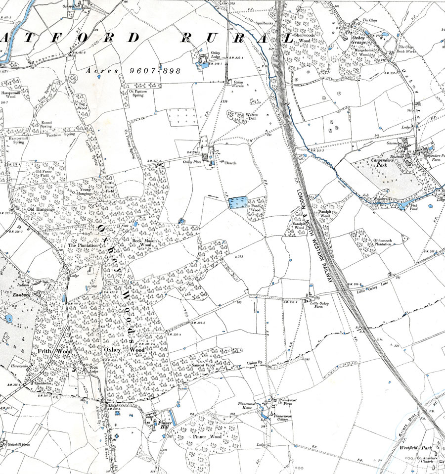
This 6 inch Ordnance Survey map of 1899 shows Oxhey prior to the building of the Estate. Oxhey Place and Lodge can be seen on the map. At that time Oxhey Woods dominated the landscape
This 6 inch Ordnance Survey map of 1899 shows Oxhey prior to the building of the Estate. Oxhey Place and Lodge can be seen on the map. At that time Oxhey Woods dominated the landscape
Copyright Hertfordshire County Council. All rights reserved.


Add your comment about this page
The old park pond is coloured in blue and is the site of Oxhey Wood School -next to it is Pond wood which is now behind the Police station. Carpenders Mansion is across to the far right – the blue coloured pond is the pond now within Carpenders Park cemetery. Eastbury House can be seen to the extreme left of the map and is now the location of the NATO base. The old house burnt down in the 1970’s